*** Update 1
Another Pre-ride was conducted on 26 Nov by Cecilie and Patrick Gaffney. Some minor comments were added to the course. RWGPS was update 2022-11-28 14:35:00 EST, and the cues are Version 7. Download the latest. Here are Patrick and Cecilie's course notes.
It was a tough course. Definitely one that looks much easier on paper. We were mostly slowed by technical issues (two flats, both of our wahoos crashing on numerous occasions, and a bike that could probably use a tune up). Similar to the Pagoda 200, there seemed to be a lot of stop signs, where stopping really was necessary, at the bottom of descents, which reduces our magic tandem powers and becomes frustrating; making it difficult for us to get into a good rhythm. I am sure it won't be as
annoying for singles.
- The right turn onto Hollow Road - there was a fair amount of gravel and a shallow cut out in the road where some utility work may be going on. Very easy to see and navigate, but it is early enough in the ride where it might be a group situation and could get a little sketchy.
- I noticed a good sized pothole in the left turn onto Summit Ave @ mile 20.2
- Along with the Milford Market there is also Bridge Street Bagel a little off course. We stopped there for a breakfast sandwich, which might be worth mentioning on the cue.
- When leaving Pottstown I believe there is a protected bike lane on Industrial road that goes up to the bridge, on the river side of the road (maybe part of the SRT?). I think you can get on it where Moser Road becomes Industrial Road. After dark some people may want to use this? We did not, and some of the cars that passed us on the road seemed annoyed that we weren't on the path.
[Ed: Patrick is talking about mile 113. There is a SRT segment accessible on the left. It begins at the traffic-light triangle intersection between Moser and Industrial Rd, just before the sewer plant on the right and the sports dome on the left. You might consider crossing over (cautiously) using it as it leads directly to the Keim St bridge and puts you in a "protected" space (look out for broken glass and barriers "protecting" you there), and if you don't use it, auto drivers might give you the stink eye, but personally I don't like the awkward left turn required to get on it. You could just as well stay right on Industrial and cross over (cautiously) when you reach Keim St. If you decide to cross over earlier rather than later, maybe it's safest to do it at the intersection: merge onto left-turn lane but continue straight onto the sidewalk on the left side of the rode which will become two lane bike path.]
 |
| Optional cross over to SRT at mile 181.9 |
- The usual large amounts of glass and crap on the outbound side of the 25th street bridge.
- In our opinion the omission of the [bike] paths doesn't change too much.
*** Original Post
A pre-ride of the Rotated Yet Another River to River Ride, Port Providence Start, was conducted on 23 November by Chris Nadovich. As a result of the pre-ride, several small course updates and typo corrections were made to the cues. The latest cue sheet is Version 5, and the latest RWGPS route was modified 2022-11-24 11:13:18 EST. Both are available online.
 |
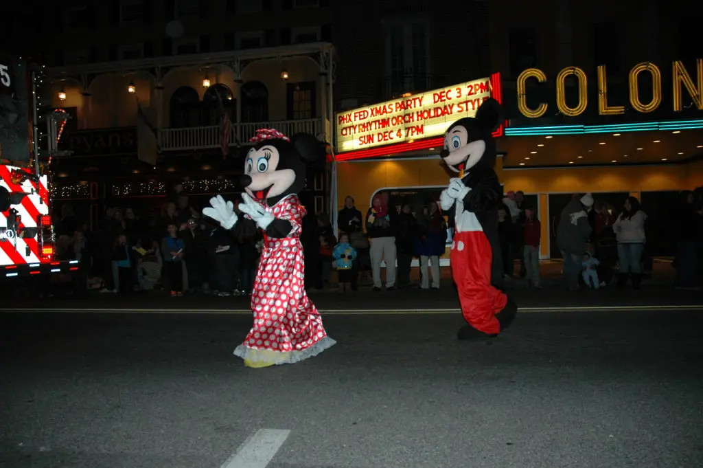
| Spectacular holiday display through Phoenixville at the finish |
Albeit a tad chilly to start out, with temperatures in the mid 20's, as the sun rose the frost evaporated and it became a great day to be on the bike. This YARRR route has always been a little too hot in the summer; as a Winter route the warmth is a lot more welcome.
This edition of the YARRR has been rotated so that the start/finish is now at Port Providence, near Phoenixville. I hope that this change makes this classic route more accessible to riders from Philly and the nearby suburbs. The finish in Port Providence has the advantage of allowing a finish gathering in the warmth of Fitzwater Station pub, rather than at the previous outdoor pavilion. The route also has been altered to eliminate virtually all of the bike trails, routing instead on nearby roads. This makes the course a little more Winter friendly.
These changes have resulted in a route that is significantly tougher than the original YARRR, which was not at all easy. Specifically, the new routing from Rieglesville to Easton includes a full-frontal attack on South Mountain, including Stouts Valley Rd and Cider Mill Rd. After humping yet again over South Mountain, this time via Lower Saucon Rd (always a favorite), there is the newly added, and glorious descent on Applebutter Rd into Hellertown. But now, instead of the flat, easy Saucon Rail Trail, the course threads throuh Hellertown via back streets, and then skirts the Kohlberg and Flint Hill via Apples Church and Taylor Rd, which are significantly "rolling".
Another challenging aspect of the route changes combined with the proximity to the Winter Solstice is that the southwestern course leg is aimed directly toward the setting sun. Don't forget your sunglasses and be very careful to look twice for traffic. The sun glare can make it difficult to see an oncoming car.
Night Riding
Many riders will be unable to complete this difficult course in the daylight and may need to ride one or more hours after sunset. Please be prepared for night riding. Darkness is only half the problem. It gets cold quickly in the Winter after sunset. Have extra layers. Batteries tend to drain quicker too. If you use batteries for lighting, make sure they are fully charged and you have extras. Reflective outer wear is a must. I recommend a full reflective vest rather than a Sam Browne sash -- the full vest acts as another wind-shell warming layer. Make sure you wear your reflective vest on the outside of your jacket! And don't forget the ankle bands outside the booties.
Finishing after dark provides a special treat at the end. You will emerge from the suburban darkness onto the main street of Phoenixville, with it's spectacular holiday light display. Happy Holidays!
 |
| Look out for cars, pedestrians, and other distracted creatures when riding through Phoenixville at night |
Historical Note
The YARRR (Yet Another River to River Ride) has a long history, perhaps longer than my own history as a bike rider. My first encounter with the concept of a bike ride between the Delaware and Schuylkill was when Pennsylvania Bicycle Club organized the River to River Century back in the early 1980s. The R2R was their second yearly club century, paired with the popular Lake Nokamixon Century. Because of limited resources, PBC eventually dropped the River to River Century from the schedule, but a few years later the Heritage Conservancy revived the same route as a PA Route 113 Heritage Corridor Century between Phoenixville and Tinicum. Their ride continues today, but (because of limited resources) the Conservancy shortened it to a metric century that now doesn't reach both rivers. Independent of these club centuries, Rick Carpenter created a River to River permanent that followed a similar path. Upon riding Rick's perm one time, which had somewhat 'utilitarian' routing that seemed to focus on donut shops and former RC homesteads. I thought I could create a prettier route without loss of calories. Thus was born yet another River to River ride. This new "YARRR" connected Easton (Delaware and Lehigh) with the Schuylkill at Phoenixville and Pottstown using the best parts of all the previous River to River courses.
--
Chris Nadovich
RBA, Eastern PA


.jpeg)
.jpg)


